Move the Plates! Teaching Plate Tectonics is Fun
Are you teaching plate tectonics and looking for a way for students to manipulate the plates while learning the types of boundaries? Would you like a digital component to add to your earth science unit?

written by
Karen Sinai
Move the Plates!
Teaching Plate Tectonics is Fun
March 2021
Utilizing plate tectonic drag and drop activities with Google Earth analysis helps make this abstract concept come alive! Students love the interactive aspect of these resources. Here is how I teach my plate tectonics unit utilizing the student’s devices.
Set up the Phenomenon
Starting my unit on plate tectonics with a phenomenon fascinates my students and peaks their curiosity. I grab their attention by showing videos of dramatic footage of recent earthquakes.
Depending on where they live in the world, the concept of the ground shaking, so much that people have to hold on, is completely foreign to them! I teach on the East Coast so when I show these videos they are usually blown away by the violence and destruction that occurs.
I choose videos that show the very distinct side to side shifting of the earth. There are usually a lot of gasps and surprised noises as the students watch the earthquakes go on for quite a long time.
Ask the Question
Now that I have their interest, I can ask the question “how in the world does an earthquake happen?” By middle school they have generally heard about the plates, but have never really studied the details.
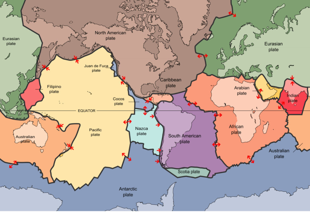
After they brainstorm as much as they can about why the earth moves, we then look at the following map. It can confuse them at first because the colors of the plates don’t match the edges of the continents. I give them a couple of moments to understand what they are seeing, pointing out familiar shapes and locations.
Now for Fun Exploration!
Now the fun begins! They use their devices to do my plate tectonics activity where the plates are on the outside of the slide view and they drag and drop them onto a map. This really solidifies the idea of large plates very quickly! I have found that they like to repeat the activity several times and sometimes they even try to time themselves as to how fast they can put them all on the map.
Utilizing Google Earth
Once students are understanding the large sections of the earth, we then look for signs of the actual boundaries by going onto Google Earth. I print out the plate tectonics map so that they can keep it in front of them as they visit the different locations on Google Earth.
We start with the most dramatic location which is the Himalayas! On Google Earth those mountains are so obviously bulldozed by India smashing into China. They are jagged and harsh looking and we compare it to a snow plow pushing snow to the edge of a parking lot. In fact, this year we had a lot of snow, so I made an extra credit assignment for them to photograph piles that had been pushed by a snowplow. I was really surprised that so many students took such great pictures!
Set up Challenging Questions
Once we have observed the boundary between India and China, I introduce the word “subduction” and talk about how India is going UNDER China. This always blows the student’s minds! I tell them that they don’t have to warn their grandchildren, or even their great-grandchildren, about India disappearing. It happens at about the rate of their hair or fingernails growing.
I then set up the challenging question of “if India is continuing to go under China, and pushing up the Himalayas more and more, why does Mount Everest stay about the same height from year to year?”. I let them ponder that overnight and give them permission to look it up.(The rate of erosion and plate tectonic movement balance each other out). It’s always fun to hear from the parents that they were also searching for the answer with their student!
Tap Into the Student’s Previous Knowledge
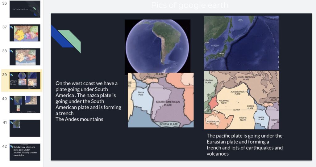
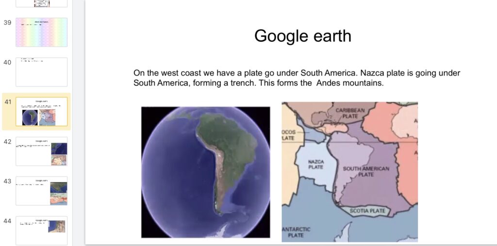
We go back to Google Earth and look for other locations that show subduction. I start with the Nazca and South American plates and talk about the Andes mountains. What do they know about that area? Some of the students may realize that there are a lot of volcanoes and earthquakes along the west coast of South America. The Google Earth view of the trench off the coast of South America is wonderful and leads to a great discussion of how trenches are formed. We then go on a hunt, looking for more trenches, which usually leads them to the edges of the Pacific plate near Japan. Again, I ask them what they know about that area in terms of earthquakes and volcanoes.
Use Digital Science Notebooks
Since I keep digital science notebooks, I use this opportunity to have the students take screenshots of the Google Earth areas that we’re discussing. I have them take pictures of the map in the corresponding area and place them side-by-side on a digital notebook Google slide. Seeing the artist’s map and then real time on Google Earth makes a big difference in their comprehension!
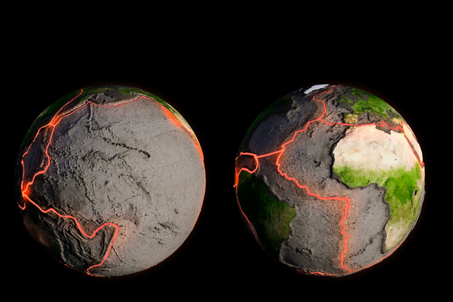
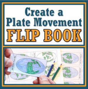
Discuss How Pangea Broke Apart To Form Today’s Continents
I recently found this super activity put together by Flying Colors Science. It is a flipbook representing the moving continents as Pangea breaks apart. This is a great introduction to the three types of boundaries and how they created what we see today.
Learn the Three Types of Plate Boundaries
Understanding the three types of tectonic boundaries is important for understanding why these dramatic events happen in the different places on earth. The three types of plate boundaries are convergent, divergent, and transform. After I introduce all three boundaries, we search for them on the map. We take screenshots again of Google Earth to compare them to the locations on the map.
I give them my drag and drop activity where they look at the overall view of the different boundaries interacting. As they work on those, they learn the vocabulary that they will need for the next project.
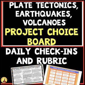
Assign a Plate Tectonic Boundaries Project
Many teachers do a lot of different hands-on activities for demonstrating the types of plate boundaries and I have tested a lot of them throughout the years. I have used clay, graham crackers and marshmallows, foam board, etc. I do enjoy doing this in class, but I really have fallen in love with an assignment that involves utilizing the student’s creativity.
They must use anything that they can find in their homes to represent the three types of plate boundaries and take a 4 to 5 second video of each boundary in action. They then put together a 15-20 second overall video. I specify that they must tell us which two specific earth plates are interacting. Students have been amazed me by using anything from snow, pieces of bread, piles of laundry, Legos, cookies, etc. I tell them that the more features, such as mountains, volcanoes and trenches that are shown, the more credit that they get!
I prefer activities like this because it forces them to go back to their notes to remind themselves of the structures and behavior of the boundaries. Depending on the ability level of my class, I may also ask them to show the three kinds of converging boundaries.
Time for Review Activities
After they have presented their projects, they then work on the four fill-in-the-blank review slides that come included with my plate tectonics resource. These can also be used as an assessment to wrap up this part of your unit.
A fun review of the boundaries is using matching pair cards to play pairing games, including concentration. This helps solidify the student’s knowledge of the three types of boundaries.
After this overview of plate tectonics, I continue to move on to a study of earthquakes, tsunamis and volcanoes. With so many real time videos, digital resources and satellite images available, it has become so much easier to bring these to life!

- Embracing The Mess: Why a “Messy” Science Classroom is a Good Thing
 Embracing The Mess: Why a “Messy” Science Classroom is a Good Thing Do you have a messy science classroom? Are supplies scattered everywhere, with half finished…
 - Why Digital Science Notebooks Make the Ultimate Study Guide
 Why Digital Science Notebooks Make the Ultimate Study Guide Do you find that your students don’t know how to study for tests?Are they losing papers, forgetting…
 - 10 Tips For Engaging Disinterested Students
 10 Tips For Engaging Disinterested Students We all know the struggle of engaging disinterested students no matter how hard we try. Over the years, I’ve found…